Zeus AI was selected for a phase II award through NASA’s Small Business Innovation Research (SBIR) program. The phase II award of $850k will enable Zeus AI to continue development and commercialize our 3D atmospheric analysis product for applications to numerical weather prediction and energy forecasting. Leveraging advances I geostationary satellite imagery in combination with advanced machine learning developments enables the production of high-frequency retrievals. Our goal is produce a 3D analysis dataset with accuracy and resolution beyond current data assimilation products provided by NOAA’s GFS and ECMWF’s ERA5.
During phase I of our project, we successfully developed a generative machine learning model to effectively translate between GOES-16 thermal infrared imagery and vertical radiosonde profiles. This technology enables Zeus AI to generate 3D atmospheric temperature, humidity, and winds at a 2km spatial, 10-minute temporal resolution. The data produces fills large gaps in NASA’s Earth Observing System (EOS) with potential downstream effects to weather forecasting at all scales.
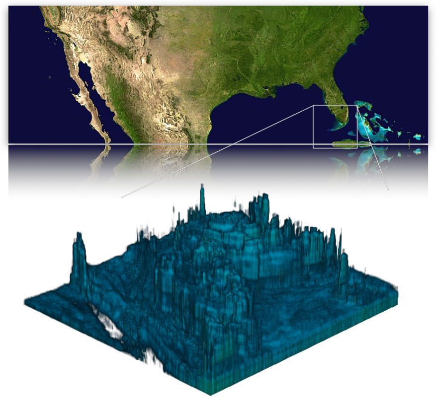
Humidity retreival visualization from Zeus-Analysis 3D during Hurricane Ian 2022.
Phase II of this project gives us the resources to scale the machine learning models, provide a more comprehensive evaluation, and commercialize with user interfaces. We will explore the utility of generative models for compressing high-dimensional satellite observations to improve efficiency further. A global validation across a suite of geostationary satellites including GOES-16/18, Himawari-8/9, GeoKompsat-2A, ad Meteosat against ground truth radiosonde and droposonde observations. An Application Programming Interface (API) will be developed for programatic access to our data and powering a web-interface.
We look forward to expanding our collaborations with groups around NASA, including our current collaborations with the Global Modeling and Assimilation Office (GMAO) at Goddard Space Flight Center. The developed machine learning capabilities are applicable to numerous applications in Earth science and satellite data processing.